According to GEOBUIZ (2018), a magazine that focuses on Geospatial Industry Outlook and Readiness Index, in Africa, Kenya is ranked 3rd after South Africa and Egypt followed by Nigeria in 4th position in spatial industry development. Geospatial technology is expected to grow in Africa, Kenya included. The growth is driven by the expansion of the user base aided by government initiatives in science and technology, ICT and capacity building. Kenya has made strides in geospatial research (PhD and Postgraduate courses) and foundational courses (Graduate, Diploma and Certificate courses). However, the Kenya institutional capacity is still low mainly because single geospatial discipline focused courses are still few. The main Kenya colleges and universities that focuses on education in geospatial certificate, diploma and undergraduate degrees are as give in A to H.
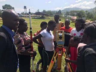 |
| Land Surveying class, Tindiret Technical and Vocational College |
A. Geomatics/Geospatial
Engineering - 5 Years
For undergraduate degree in geomatic and/or geospatial engineering, the following are requirements and the universities.
Requirements
- Engineering entry requirements as per Kenya university policies
- Often entry points are around A, A- in KCSE
- Often takes about 5 Years
- Mathematics, Physics and Geography are key
Universities
B. Geospatial Degrees – 4 Years
For other undergraduate degree in GIS, the following are requirements and the universities.
Requirements
- Often entry points are around B, B-, or C+ in KCSE
- Often takes about 4 Years
- Mathematics, Physics and Geography are key
Universities
- New kid in the block - Taita Taveta University – Voi
- Bachelor of Science in Geo-Informatics - https://www.ttu.ac.ke/course/bachelor-of-science-in-geo-informatics/
- School of Planning and Architecture - Spatial Planning and GIS, link is https://www.maseno.ac.ke/index/index.php?option=com_content&view=article&id=296&Itemid=370
- Bachelor of Arts – Geography - https://sass.mu.ac.ke/index.php/k2-categories/undergraduate/ba-geography
- Bachelor’s degree in GIS - Department of Geospatial and Space Technology, School of Engineering, Link: https://geospatial.uonbi.ac.ke/
- Bachelor’s degree in Geography - Geography Department
- Jomo Kenyatta University of Agriculture and Technology –
- Bachelor’s degree in GIS - Department of Geomatic engineering and GIS, Link: http://www.jkuat.ac.ke/departments/gegis/
- Bachelor of Science in Data Science and Analytics - BSC-Data-Science-and-Analytics-advertisement.pdf (jkuat.ac.ke)
- Bachelor’s degree in Geodetic Science and Navigation domain
- Bachelor’s degree in Surveying Science and Technology domain
- Bachelor’s degree in Geoinformation and Earth Observation domain
- Dedan Kimathi University of Technology - Institute of Geomatics, GIS and Remote Sensing (IGGRS); Link - https://iggres.dkut.ac.ke/
- Bachelor’s degree in GIS
- Kenyatta University – Environmental science - rich of GIS-Remote Sensing,
- Kabianga University – Urban and Regional Planning, rich of GIS-Remote Sensing
C. Colleges offering Land Surveying
For Certificate in Land Surveying and Diploma in Land Surveying, the following are requirements and the colleges.
Requirements
- Diploma entry points are around C, C-
- Entry for Certificate is D+
- Diploma takes about 2 and a half years - KNEC examined
- Certificate takes 1 and half years - KNEC examined
- Mathematics, Physics and Geography are key
Colleges
 |
| RCMRD - Regional Centre Training Institute |
- Regional Centre Training Institute - RCTI under RCMRD http://www.rcmrd.org/diploma-courses/
- Kenya Institute of Surveying and Mapping (KISM) under Ministry of Lands and Physical Planning
- Sigalagala National Polytechnic
- Kitale National Polytechnic
- Ol'lessos Technical Training Institute
- Sang'alo Institute of Science and Technology
- Eldoret Polytechnic
- Ramogi Institute of Advance Technology
- Kenya Institute of Highways and Building Technology
- Bondo Technical Training Institute
- Aldai Technical Training Institute
- Siaya Institute of Technology
- Tindiret Technical and Vocational College
- The two institutes in Nyamira County – still looking for their exact names
D. The 2
colleges offering the 2 Diplomas
For Diploma in Cartography and Diploma in Photogrammetry and Remote Sensing, the following are requirements and the colleges.
Requirements
- Often entry points are around C, C- in KCSE
- Often 2 and a half Years
- Mathematics, Physics and Geography are key
- KNEC examination
Colleges
E. The
only college offering this Diploma
For Diploma in Map reproduction – Printing technology of maps, it’s only the Kenya Institute of Surveying and Mapping under Ministry of Lands and Physical Planning offering it.
Requirements
- Often entry points are around C, C- in KCSE
- Often 2 and a half Years
- Mathematics, Chemistry and Geography are key; note its the only geospatial Diploma that doesn't need Physics.
F. Awaiting evaluation and approvals
The following are in the process of evaluation;
- Certificate in Cartography – University
- Diploma in Cartography and GIS – University
- Diploma in Photogrammetry and Remote sensing – University
G. Admissions/Applications
- Admissions into government colleges and Universities is done through Kenya Universities and Colleges Central Placement Service (KUCCPS) - https://kuccps.net/
- Application of admission into Regional Centre Training Institute – RCTI is through the email: rcti@rcmrd.org
H. General Notes
- Courses are continually reviewed by government; a course that is there today, can be changed tomorrow or even renamed.
- Most colleges above are Technical Vocational Education and Training (TVET) approved by TVET authority under Kenya government; meaning one can access HELB education funds once admitted.
- Government and few organizations give scholarships once in a while under TVET programmes, above courses included. One has to keep looking out for the said scholarship announcement.
- Kenya Institute of Surveying and Mapping (KISM) under the Ministry of Lands and Physical Planning sometimes put independent advert in the media of their geospatial courses.
- English is language of instructions
- Mmmm, all the above colleges and universities offering geospatial certificate, diploma and degree are all inter-linked and Yes! they share staff in some specializations.
- They are recognized by the related professional bodies
Kenya Related links;
Compiled by Lucy Chepkochei 'Chep-GIS' , April 2021


